FRIDAY/FRIDAY NIGHT
Scattered showers will be possible at any time Friday, but Friday night into Saturday morning offers the best chance for widespread showers and possible thunderstorms as a secondary wave arrives from the southwest. Tracking future radar at various times.
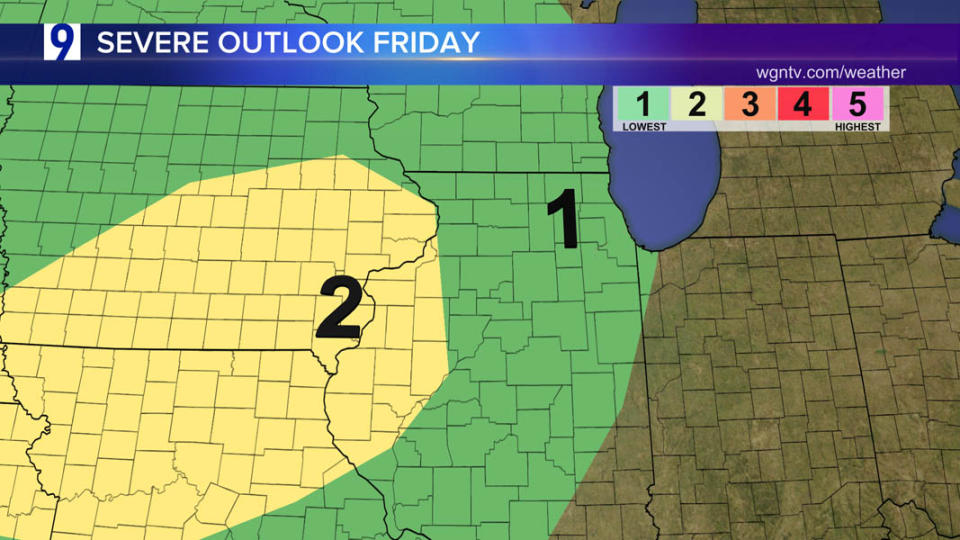
FRIDAY SEVERE OUTLOOK
Active weather returns for at least part of the area Friday afternoon and Friday night bringing the next chance for scattered thunderstorms following a quiet Thursday.
Typical summer fashion, rainfall this month has varied widely, areas downstate have seen much less rain than normal.
Across the Chicago area, totals have been close to normal, but several locations have seen quite a bit more than what typically falls.
NORMAL RAINFALL through June 26 is about 3.60”
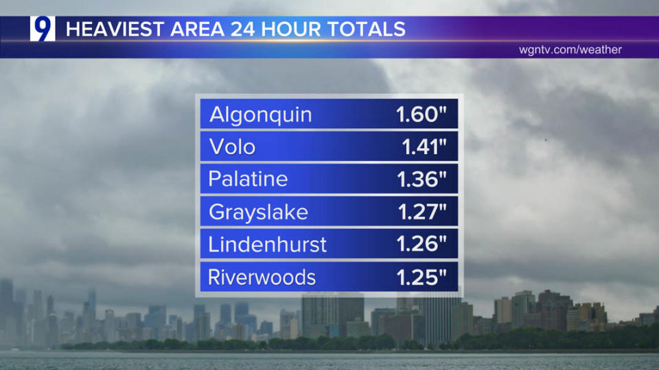
Heaviest area 24 hour rainfall through 9AM Wednesday
Sample of area rainfall totals:
North/northwest suburbs logged the heaviest totals.
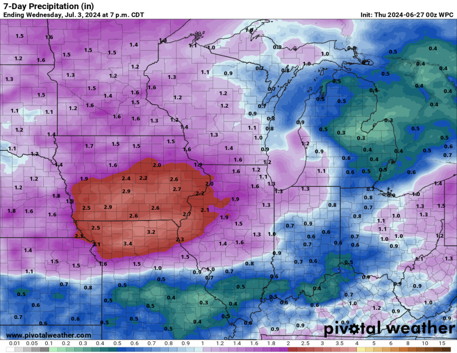
More heavy rainfall possible over the next week
Blended models suggest areas that areas already waterlogged from recent torrential rains may be in line for more heavy rainfall at times over the next seven days. This includes portions of Iowa, Missouri and western Illinois.
Copyright 2024 Nexstar Media, Inc. All rights reserved. This material may not be published, broadcast, rewritten, or redistributed.
For the latest news, weather, sports, and streaming video, head to WGN-TV.
Signup bonus from
