TAMPA, Fla. (WFLA) – A prominent wind that comes from the Gulf of Mexico can change our weather pattern slightly this time of year.
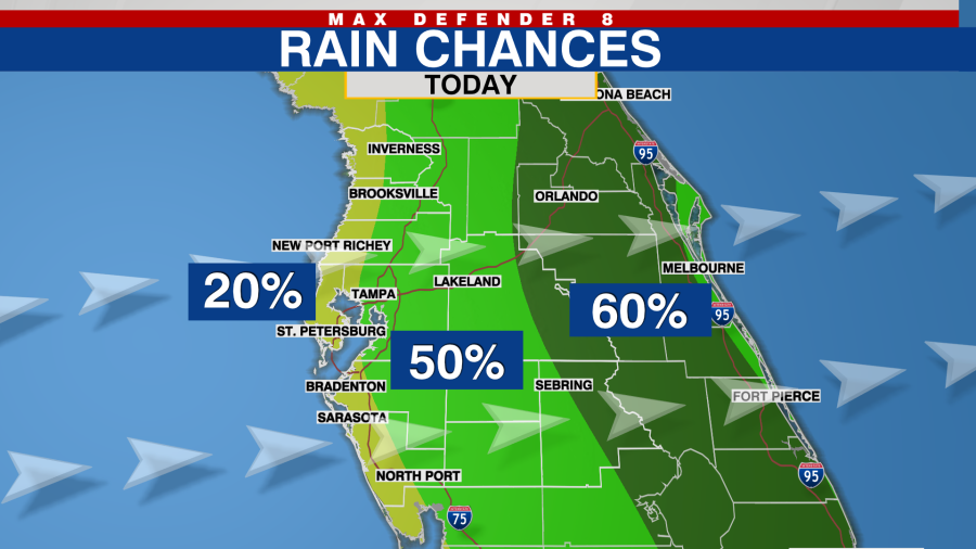
Watch for a few spotty showers before lunchtime closer to the coast. The breeze begins to spread the downpours farther inland by the early afternoon. In fact, the best coverage of rain should be before 4pm. Later in the day, the heaviest rain gets pushed out of our communities and closer to the east coast.
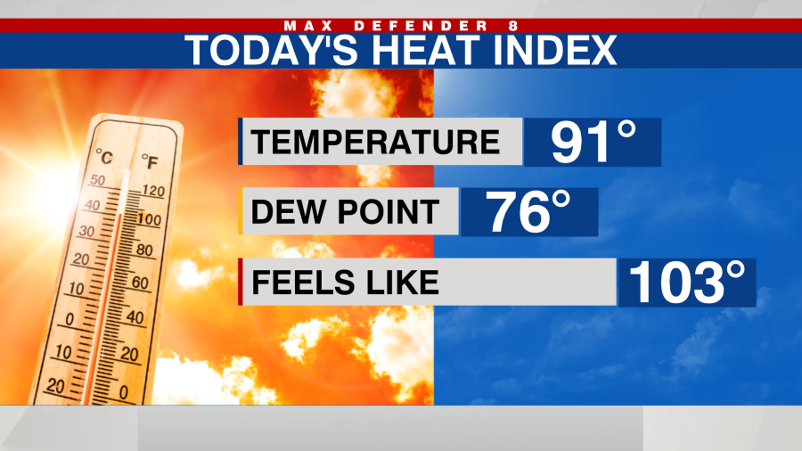
The onshore wind also increases our humidity a bit as well, so temperatures in the low 90s feel like the low 100s.
The onshore pattern is even more evident tomorrow, so our rain chances drop to 30%. Any showers that form push quickly out of our area. The pattern breaks down slightly Friday, so a few late-day downpours linger in our inland areas.

We return to a “classic” summer weather pattern this weekend. Expect mainly dry conditions in the morning, and widespread downpours develop late in the afternoon and into the evening. Some of these storms drift toward the Gulf of Mexico.

Expect hot conditions this weekend before those storms form. Similar weather is expected for the first part of next week.
Thanks for signing up!
Watch for us in your inbox.
Subscribe Now
Copyright 2024 Nexstar Media, Inc. All rights reserved. This material may not be published, broadcast, rewritten, or redistributed.
For the latest news, weather, sports, and streaming video, head to WFLA.
Signup bonus from