ORLANDO, Fla. – So far, this morning has featured plenty of sunshine which is really helping to heat our temperatures up. It will be a downright sweltering day, with afternoon highs soaring well into the low and middle 90s, with feels like temperatures in the low 100s.
If you have outdoor plans, be sure to stay hydrated and take plenty of breaks! A heat advisory is in place for Flagler, Marion, Alachua, Gilchrist, and Dixie Counties until 7pm. Some heat indices could approach 110°!
The first half of our day will be dry and mostly sunny, but that changes as we head into the early afternoon hours.
Storms will begin to fire and pop up around 3pm near the I-75 corridor. These will continue to work eastward through the evening and will grow more widespread gradually.
Today won’t be a total washout for everyone, but those who do see the showers and storms can expect heavy downpours and frequent lightning.

LOOKING AHEAD: The last few days of June will certainly be feeling summer-like across Central Florida. Plan for daily rounds of afternoon showers and storms along with sweltering temperatures just about every single day this week. Daily afternoon highs will be well into the low and mid 90s.
TROPICS: The NHC is monitoring a disturbance near the Windward Islands for the low chance of tropical development over the next 7 days. So far, it’s a low chance (20%) as it moves into the western Caribbean by late this week.
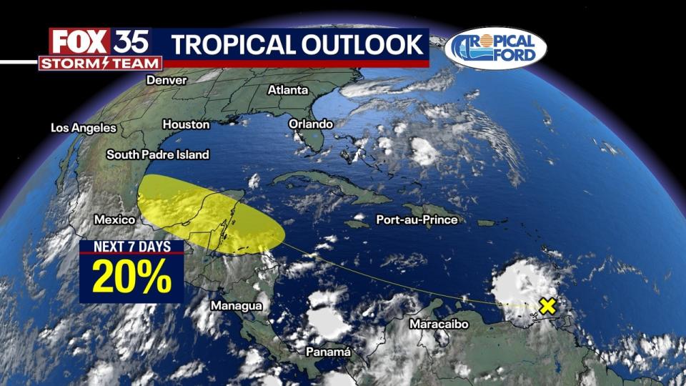
Extended models bring Saharan dust towards FL and the Gulf of Mexico by this weekend which will help limit much of our tropical development over the next week or so.
Signup bonus from