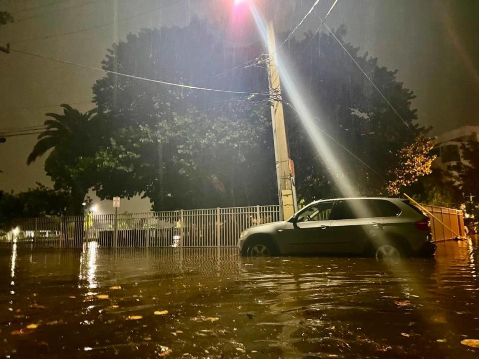
South Floridians, prepare to see more oppressive rainfall on Thursday that pounded the region for the past two days — prompting wide-scale flash flooding and closures, according to forecasters.
Early weather models indicate Miami-Dade and Broward Counties could experience another bout of heavy showers that will bring down at least 2 to 3 additional inches, said George Rizzuto, a meteorologist with the National Weather Service’s Miami Office.
“The general feeling is that it could be pretty similar to what we saw [Wednesday],” Rizzuto said.
The downpour will ramp up in the late morning and continue into the evening. From 1 p.m. to 8 p.m., both counties have an 80% to 90% chance of rain.
The areas predicted to be most affected are those that have already experienced severe flash flooding — southern Broward, northern Miami-Dade and packed metro areas.
“Unfortunately, those are the areas that were hit hardest,” Rizzuto said. “It could be a bit dicey, the hardest hit areas will be hit again.”
READ MORE: ‘We’re prepared for the worst’: South Floridians weather ‘rare’ flash flood emergency
The same regions are currently under a flood warning and watch. The warning concludes at 8 a.m. Thursday; the watch lasts until Friday evening.
Regarding flash flooding warnings or another rare emergency situation, Rizzuto said it would not take much for one to be issued, given the amount of water still on the ground.
“It’s not going to take much rainfall to warrant a flash flood,” he said.
The official total of rain on Wednesday has not been tallied. However, the weather service reported between 5 and 13 inches of rain fell in both counties as of late Wednesday.
Florida, Miami-Dade County, Broward County and several cities — namely Miami and Fort Lauderdale — have already issued a state of emergency, which is meant to aid recovery efforts but will also help if weather continues to be severe.
READ MORE: Rainfall deluge shutting down Miami and Ft. Lauderdale. Trains, bus and planes halted
If South Florida experiences another dangerous deluge, residents are in for another round of closures.
Hundreds of flights were canceled at Miami International Airport and Fort Lauderdale-Hollywood International Airport. The Tri-Rail and Brightline halted some of its services.
Universities canceled classes and closed some campuses. Some roads were impassible, and a stretch of Interstate 95 was completely shut down for hours.
READ MORE: Torrential rain, flooding shuts down I-95 near Fort Lauderdale airport
On Normandy Isle, a neighborhood of Miami Beach, Simon Suarez tried to drive his Mini Cooper on low-lying South Shore Drive, which was inundated. About 500 feet from his apartment, the car gave out in the nearly waist-high water early Wednesday evening.
“I had to get out through the sunroof,” said Suarez, 48. “My neighbor helped me push it out of the water.”
Hours later, when his wife tried to start the car, water spewed out of the exhaust pipe. At 11 p.m., they camped out in the car near the water’s edge, waiting for the flood to recede.
Miami Herald reporter Joey Flechas contributed to the report.
Signup bonus from