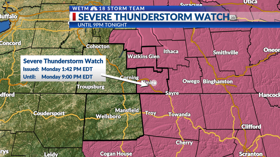
The NWS Storm Prediction Center has issued a
-
Severe Thunderstorm Watch for portions of
New Jersey
Central and Eastern New York
Eastern Pennsylvania
Lake Ontario
Coastal Waters -
Effective this Monday afternoon and evening from 145 PM until
900 PM EDT. -
Primary threats include…
Scattered damaging wind gusts to 65 mph possible
Isolated large hail events to 1 inch in diameter possible
A tornado or two possible SUMMARY…Scattered thunderstorms are expected to gradually
intensify this afternoon within a destabilizing environment ahead of
a fast-moving upper-level system over the Northeast. The severe thunderstorm watch area is approximately along and 80
statute miles east and west of a line from 50 miles northeast of
Watertown NY to 30 miles west southwest of Philadelphia PA. For a
complete depiction of the watch see the associated watch outline
update (WOUS64 KWNS WOU3). PRECAUTIONARY/PREPAREDNESS ACTIONS… REMEMBER…A Severe Thunderstorm Watch means conditions are
favorable for severe thunderstorms in and close to the watch area.
Persons in these areas should be on the lookout for threatening
weather conditions and listen for later statements and possible
warnings. Severe thunderstorms can and occasionally do produce
tornadoes.
Copyright 2024 Nexstar Media, Inc. All rights reserved. This material may not be published, broadcast, rewritten, or redistributed.
For the latest news, weather, sports, and streaming video, head to WETM – MyTwinTiers.com.
Signup bonus from