East Tennessee remained at risk of severe weather heading into tonight, as reports came in of one death in Claiborne County and a warehouse roof collapse in Knox County.
A staff member at the Claiborne County Office of Emergency Management confirmed a person was killed at about 10:30 a.m., after a tree fell on a vehicle at Lone Mountain Road and Jennings Road in Tazewell.
Two people were taken to the hospital with minor injuries after Rural Metro Fire responded to a reported roof collapse at the PSG warehouse on South National Drive at about 12:30 p.m., according to a department Facebook post. When the initial crews arrived, they found evacuations in progress with a partial collapse of the roof in the warehouse area. In the collapse, a large water and gas line were damaged, causing a massive gas leak inside the building.
Overnight hail, tornadoes and flooding possible in Knoxville
It’s not just heavy rains and winds Knoxville has to worry about this evening. Large hail, flooding and tornados are also possibilities into the overnight hours, according to the National Weather Service in Morristown.
Most of the risks this evening are expected along I-40 from Knoxville to the west, including the northern Cumberland Plateau. As the night goes on, severe threats are possible south of I-40.
Knoxville area is under a tornado watch
Knox County and areas to the west of here are under a tornado watch until midnight.
In fact, much of the Southeast is blanketed with watches warnings reaching into Alabama, Georgia, Mississippi and North Carolina.
What’s a tornado watch? A tornado watch means residents of the specified area should be prepared because tornadoes are possible in and near the watch area. People should be ready to act quickly if a warning is issued or if they suspect a tornado is approaching, according to the National Weather Service website.
Severe weather could continue until sunrise Thursday
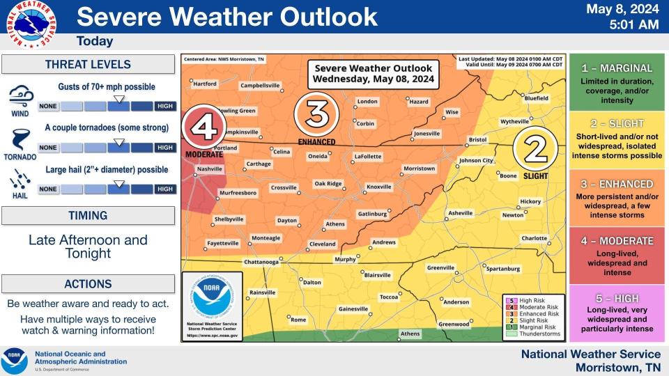
The severe weather risk for East Tennessee was upgraded to “enhanced,” which means residents could face more persistent and widespread bad weather, as well as a few intense storms, through this evening.
“Severe storms will continue this afternoon and into the night time hours,” the National Weather Service’s Morristown office posted. “Expect storms to clear out around sunrise on Thursday morning.”
The Morristown office posted weather maps that show much of the region as far east as Johnson City under a 30-44% chance of severe wind, over 58 mph. Knoxville faces a similar probability of severe hail of more than an inch in diameter.
The likelihood of a tornado in the area, meanwhile, was rated at 5-9% as of Wednesday morning.
What is the timing of the storms in Knoxville and East Tennessee?
The most severe weather hit at 1 p.m. in Sunbright (which was hit by serious tornado damage in April) and LaFollette.
The brunt of the stormy weather is likely to hit between 7 p.m. and 1 a.m. in Knoxville, the weather service said. It should be clearing the region by 5 a.m.
East Tennessee is under a flood watch
A flood watch is in effect through the morning in East Tennessee. A small area south of Oak Ridge and west of Knoxville is under a lesser flood advisory.
“Those living in areas prone to flooding should be prepared to take action should flooding develop. Turn around, don`t drown when encountering flooded roads. Most flood deaths occur in vehicles,” the weather service warned.
East Tennessee residents could see tornadoes overnight
The severe thunderstorms will be capable of producing damaging winds and tornadoes, the weather service warned.
“Remain vigilant and aware of any current watches,” the weather service posted, offering tips that included creating a communication plan for family members and mapping an evacuation route.
During this storm, any potential tornadoes could crop up long after residents have gone to bed. That’s not unusual for East Tennessee, meteorologists say.
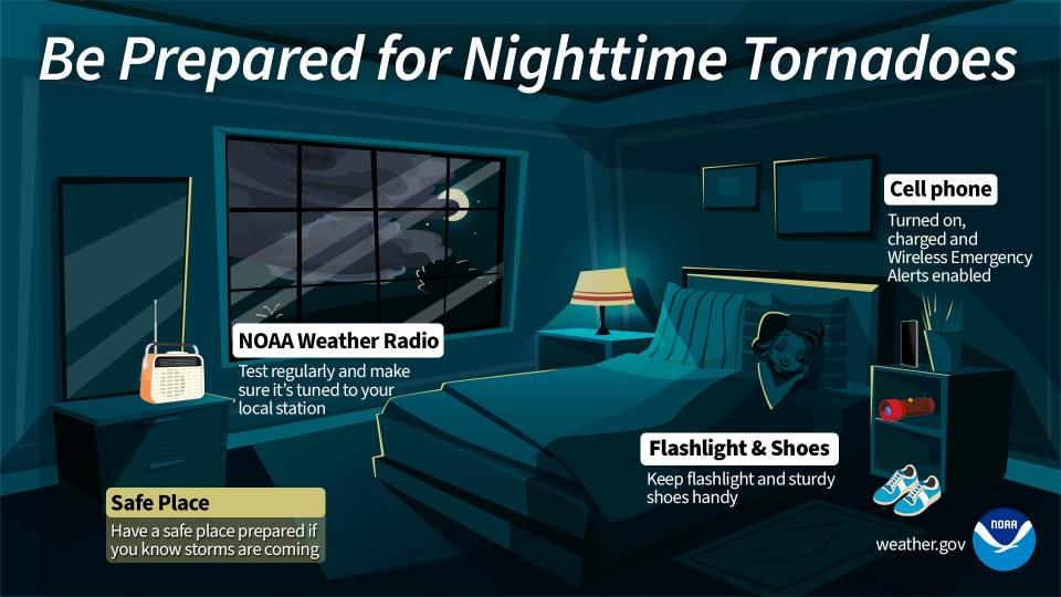
To stay current on tornado warnings, buy a digital weather radio. Also, sign up for the county’s emergency warning system, which sends alerts by text, email or voice phone call. Users can choose the locations for alerts, such as a home or work address.
To register for the emergency warning service, sign up for the system by going to https://knoxcounty.org/alert/index.php. You can also sign up by calling 311 or 865-215-4311.
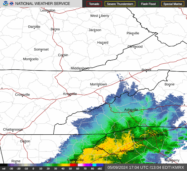
Knoxville weather radar
Knox News reporter Areena Arora contributed to this report.
Liz Kellar is a Tennessee Connect reporter. Email liz.kellar@knoxnews.com.
Support strong local journalism by subscribing at knoxnews.com/subscribe.
This article originally appeared on Knoxville News Sentinel: Knoxville area weather: One killed, two injured as storms continue
Signup bonus from