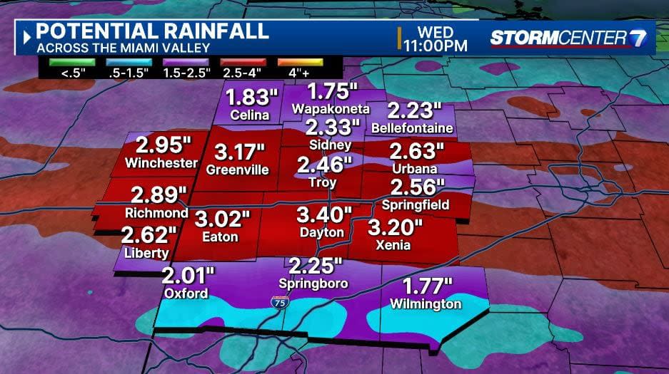
The National Weather Service has issued a Flood Watch for most of the region starting this afternoon until tomorrow night. This includes Butler, Champaign, Clark, Clinton, Darke, Greene, Miami, Montgomery, Preble, and Warren counties in Ohio. This also includes Union and Wayne counties in Indiana.

Storm Center 7 Meteorologist Britley Ritz continues to track these storms and will have a full update starting this morning at 4:25 a.m. on News Center 7′s Daybreak.
QUICK-LOOK FORECAST:
>> TRACK THE LATEST CONDITIONS: Live Doppler 7 Radar
FULL DETAILS:
MONDAY: Showers and thunderstorms looking likely early with a bit of a break before more chances return later in the day, according to Storm Center 7 Meteorologist Britley Ritz.
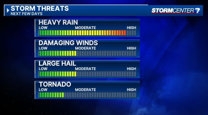
Repeated rounds of heavy rain and the potential for strong storms are on our radar to watch. Highs in the middle 60s. There will be a wide temperature gradient so some may stay in the 50s north and some may hit 70 south. We will have to watch for flooding concerns here with repeated rounds of heavy rain
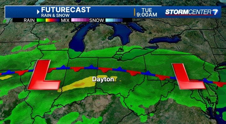
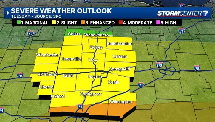
TUESDAY: Showers and a few thunderstorms could continue into Tuesday morning. Additional thunderstorm activity looks likely later in the day with more chances for heavy rain or strong storms.
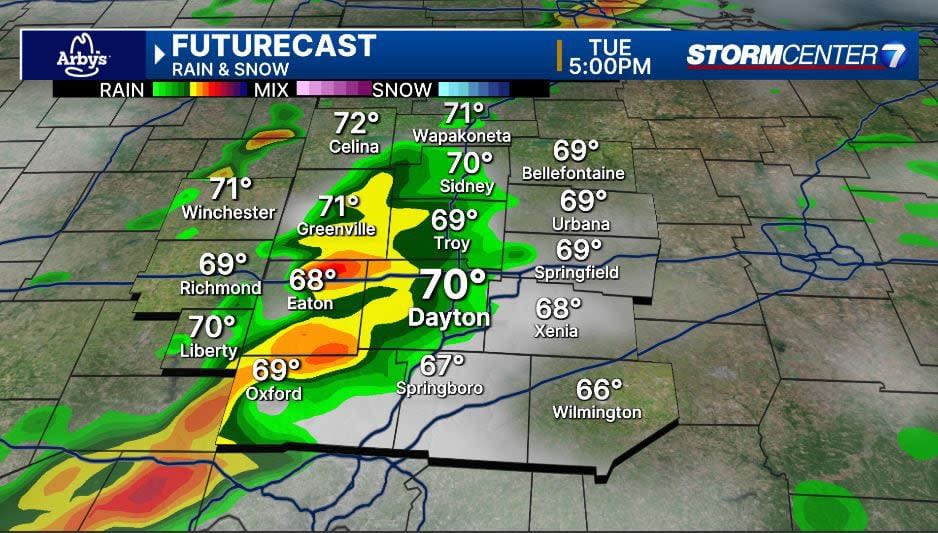
Best chance of severe weather exists here as of now. Certainly need to keep an eye on this as we move closer.
Highs a bit cooler in the lower to middle 60s. High water issues may linger into Tuesday with more rain.
WEDNESDAY: Windy and much colder with rain showers mixing with snow showers by afternoon. Highs in the middle 40s.
THURSDAY: Lingering rain or snow showers, mainly early. Staying cloudy. Cool with highs in the mid 40s.
FRIDAY: Sunshine returns gradually with clouds and still cool with highs near 50.
SATURDAY: Sunshine and a bit milder with higher in the middle 50s.
SUNDAY: (ECLIPSE EVE!) Sunshine and a bit milder with highs in the upper 50s. There will be a few clouds as well.
Signup bonus from