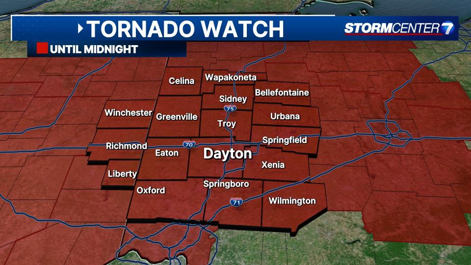
A Tornado Watch has been issued for Butler, Champaign, Clark, Clinton, Darke, Greene, Miami, Montgomery, Preble, Shelby and Warren until midnight.
A Tornado Warning has been issued for Delaware and Union until 9:45 p.m.
A Severe Thunderstorm warning has been issued for Wayne County, Indiana.
A Severe Thunderstorm Warning has been issued for Champaign, Logan, Miami and Shelby until 10 p.m.
A Severe Thunderstorm Warning has been issued for Darke, Montgomery, Preble, and Wayne County (Indiana) until 10 p.m.
A Flood Advisory has been issued for Auglaize, Logan, Shelby until midnight.
QUICK-LOOK FORECAST:
-
Severe storms likely this evening
-
Trending colder for the weekend
-
Snowflakes possible early next week
Storm Center 7 Chief Meteorologist Austin Chaney continues to track this system and will have updates later today at 5:30 p.m., and 6 p.m. on News Center 7.
>> TRACK THE LATEST CONDITIONS: Live Doppler 7 Radar
DETAILED FORECAST:
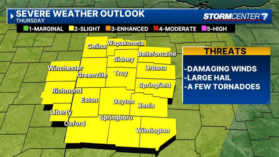
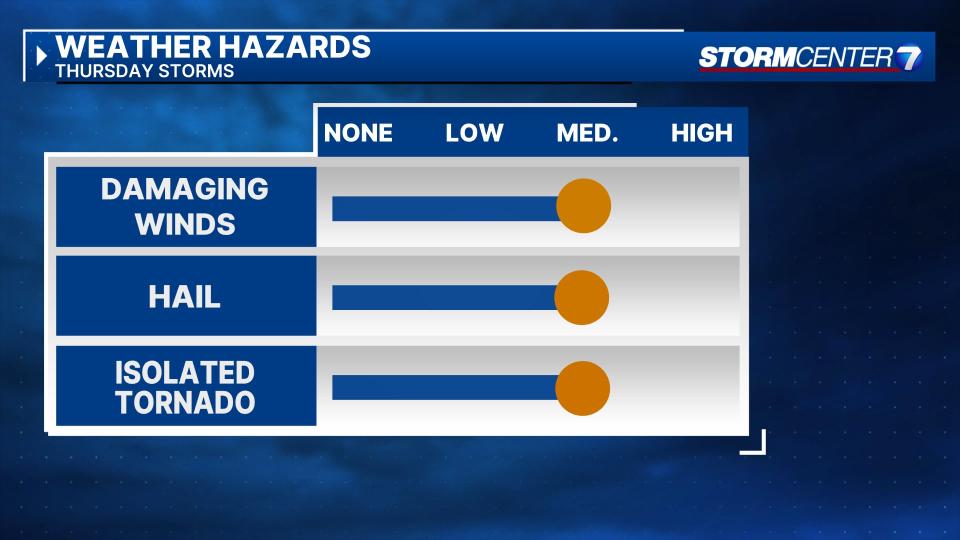
THURSDAY: The afternoon round of storms exits leaving some quiet time through early evening. The sun will probably come back out at times. After 6:30, the severe weather threat ramps up. All severe weather hazards are possible including damaging winds, hail, and a few tornadoes.

The severe weather threat should wind down after 10PM. A secondary threat will be the potential for flash flooding. If storms “train” or move over the same location time and time again, flash flooding. Temps ultimately fall to the low 50s by Friday morning.
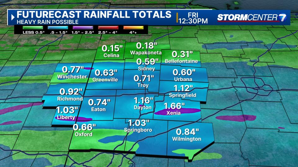
FRIDAY: Cloudy with rain showers possible, especially early south of Dayton. Drier into the afternoon with some sunshine. Highs in the low 50s occur early in the day. Temperatures holding steady or falling during the afternoon
SATURDAY: Mostly sunny. Cooler and breezy with highs in the mid 50s.
SUNDAY: Partly cloudy. Can’t rule out a shower, mainly early. Breezy. Highs again in the low 50s
MONDAY: Mostly cloudy, cool, breezy. A slight chance for rain or snow showers. Highs in the upper 30s to lower 40s.
TUESDAY: Partly cloudy. Cool again with highs in the lower 40s.
WEDNESDAY: Partly cloudy. Staying cool with highs around 50 degrees.
THURSDAY: Mostly cloudy. Cool with highs in the mid 50s.
Signup bonus from