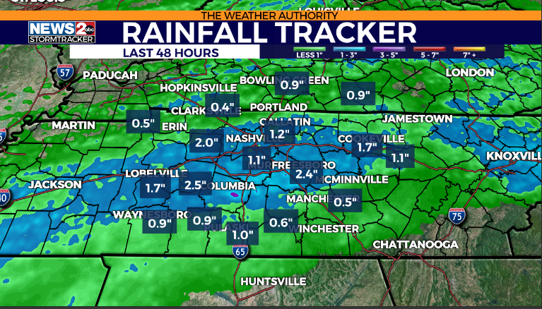
NASHVILLE, Tenn. (WKRN) — Doppler radar rainfall estimates have shown most areas in Middle Tennessee and Southern Kentucky have received anywhere from 0.5 inches to 2.5 inches of rainfall during the last 48 hours.
FORECAST: Middle Tennessee & Southern Kentucky Weather
So far, there have been no reports of flooding across the areas, but that will continue to be monitored over the next 48 hours. The heaviest rainfall will likely be in our southern and southeastern counties in Middle Tennessee.
As a frontal system slips southward across the area, rain will continue most of tonight, before temporarily tapering off before sunrise Sunday. We will enjoy a break for a little over half a day.
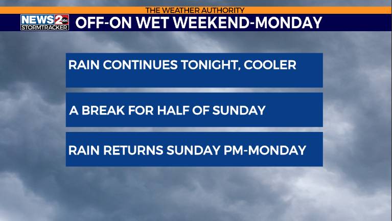
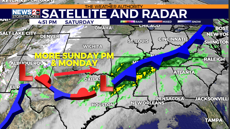
However, expect more rain to move in Sunday during the late afternoon and evening hours as a low-pressure center heads our way from the southwest. That rain will persist on Monday, tapering off Monday night. The Cumberland Plateau may see a few snow showers of flurries Monday night on the tail end of that system as it exits the area.
RADAR | Track weather across TN live
Below is a sequence from Future Tracker. Click on the arrows to cycle through the periods.
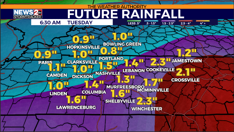
Expect another 0.5 inches to 2.0 inches of rain over the next 48 hours.
Don’t forget to take the power and reliability of the WKRN Weather Authority with you at all times by downloading the News 2 Storm Tracker app.
For the latest news, weather, sports, and streaming video, head to WKRN News 2.
Signup bonus from