A winter storm bringing snow, wind, and coastal flooding to parts of Massachusetts early next week is brewing.
Details of the storm are not final as it hasn’t formed yet. The track will pass offshore Monday night to Tuesday morning with the chance for snow inland and some mixing/rain along the southeastern coast and Cape.
“A further track inland would mean a warmer track, we’re not seeing that so much anymore and it does look like a classic nor’easter with snow but also rain and a mix in some spots,” Meteorologist Vicki Graf said in her Saturday morning weather forecast.
It’s too early for specific numbers with our next storm, since it still hasn’t fully formed. Right now it does look like parts of our area could see more than 6″ of snow. We will also have to deal with some wind & coastal issues. Stay with us as we track this next impact storm! pic.twitter.com/omr5eC2MZE
— Vicki Graf (@VickiGrafWX) February 10, 2024
Wind and coastal concerns will also be involved in this storm, Graf said.
“If that track pushes it further out it will be a cold track but also less snow,” Graf added.
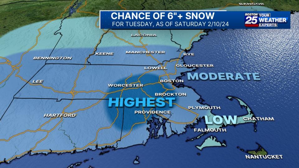
Southwest of Boston will see the highest chance of snow as of Saturday morning, but that could as change as the storm continues to form.
“It’s still too early to put an actual snowfall total map because we are still several days out,” Graf said.
Graf says the details of the storm are still coming into focus.
Stay with the Boston 25 Weather Team for updates as the storm forms and gets closer.
This is a developing story. Check back for updates as more information becomes available.
Download the FREE Boston 25 News app for breaking news alerts.
Follow Boston 25 News on Facebook and Twitter. | Watch Boston 25 News NOW
Signup bonus from


