Following a weekend of heavy precipitation and gusty winds, the Tahoe region is bracing for more snow — and possible avalanches, according to the National Weather Service.
Over the past week, Tahoe experienced a series of winter storms as a result of an atmospheric river that coursed through California.
The Sierra Nevada, including the Tahoe region, received heavy amounts of snow, the UC Berkeley Central Sierra Snow Laboratory reported.
In the past 24 hours, the laboratory reported to have received about 21 inches of snow, and “plenty more” is still expected to fall.
We received 14.8″ (37.5 cm) of #snow in the last day and 20.7″ (52.5 cm) in the last 2 days. We are expecting plenty more today.
High winds caused power interruptions overnight but everything is back online.
Pic: Weighing snow samples to get their water content.#CAwx #CAwater pic.twitter.com/G3qmnrFAJg
— UC Berkeley Central Sierra Snow Lab (@UCB_CSSL) February 5, 2024
What’s the avalanche danger in Tahoe?
While avalanches can occur at any elevation due to heavy amounts of snow layered upon a slope, people could also potentially trigger an avalanche when traveling below or near a slope.
On Sunday morning, the Sierra Avalanche Center issued an avalanche warning for the central Sierra Nevada mountains, including the Lake Tahoe region, in effect until 7 a.m. Tuesday.
“An intense pulse of snowfall is expected to deposit another foot of new snow this morning,” the center announced Monday in its daily avalanche forecast. “This combined with strong winds will fuel ongoing snowpack instability and keep natural avalanches very likely today.”
According to the center’s forecast, which ranks avalanche risks on a scale of one to five, Monday’s avalanche danger is at a four, or, “high,” in backcountry areas.
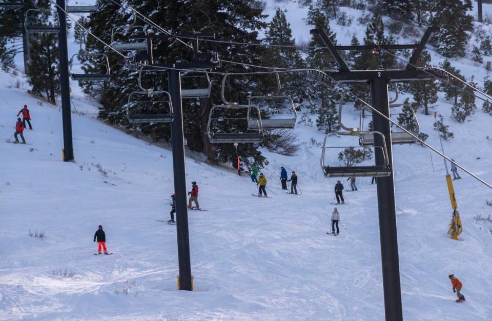
How much snow has fallen at Tahoe’s ski resorts?
As of Monday, here’s how much snow has fallen at ski and snowboarding resorts in Tahoe so far this season, according to their websites:
What’s in the weather forecast for Tahoe?
Snow is in the forecast for South Lake Tahoe over the next five days, according to the National Weather Service.
Tahoe is expected to see snow showers on Monday evening. Skies will be mostly cloudy, with a low around 20 degrees and gusts around 5 miles per hour.
Up to 2 inches of new snow is possible.
On Tuesday, there is a 70% chance of snow likely before 4 p.m. with a high near 36 degrees and a low around 17. Less than half an inch of new snow is possible.
Wednesday’s forecast shows a 40% chance of snow with partly sunny skies. The high will be near 35 degrees and the low will be around 15 degrees with gusts nearing 10 miles per hour.
Thursday is expected to see a 40% chance of snow mainly after 10 a.m. Skies will be partly sunny with temperatures as high as 33 degrees and as low as 15 degrees.
On Friday, there will be a slight chance of snow. Skies will be mostly cloudy with a high near 34 and a low around 13.
How’s the snowpack looking so far in California?
While this winter season has been wet, California’s precipitation has not produced nearly as much snow as the previous water year, according to The Sacramento Bee’s latest drought update.
The snowpack had recorded 29 inches of snow as of Jan. 30 during a snow survey by the state water agency.
That’s 58% of the average to date, department spokesperson Ryan Endean said in a briefing after the survery.
California might experience above-average rainfall in 2024 along with below-average snowfall, resulting in a “snow drought,” officials said in the briefing.
What do you want to know about life in Sacramento? Ask our service journalism team your top-of-mind questions in the module below or email servicejournalists@sacbee.com.
Signup bonus from