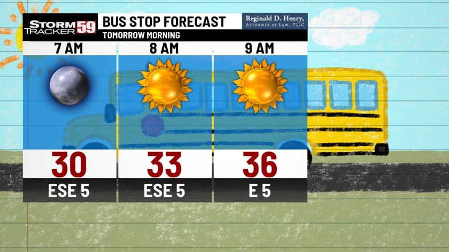
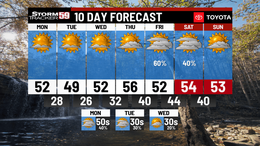
Tonight, we end the weekend on a fantastic note as we enjoy a mostly clear night. We’ll have a few clouds push through near the southern border of West Virginia and Virginia, but we’ll remain dry and calm otherwise. The only thing to be mindful of is the temperatures as they drop near 30 degrees tonight.

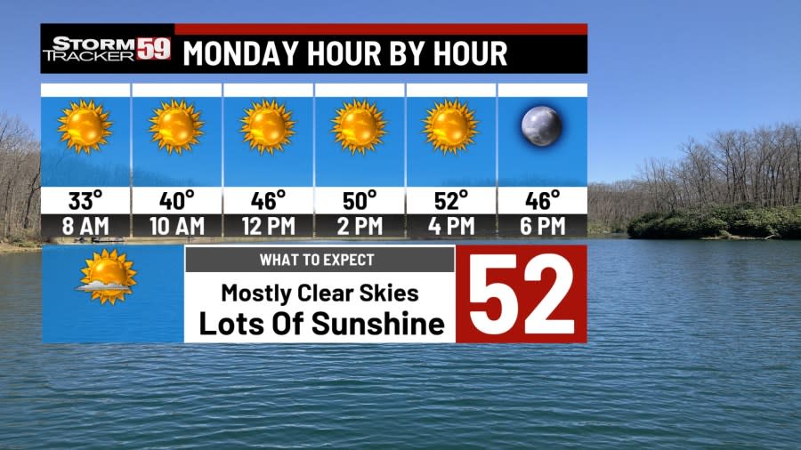
Monday keeps our fantastic weather around to start next week. Outside of another cold start in the morning, we’ll enjoy a nice warmup back into the 50s for your Monday. Not much in the way of cloud cover either as nearby high pressure keeps our skies mostly sunny!
Tuesday will look like a carbon copy of Monday but in the best ways possible. Still another cold morning in the 20s so you’ll probably need those jackets for anyone heading off to work or school. We’ll officially make it back into the upper 40s, low 50s as our mostly sunny trend continues!

Wednesday completes the hat trick for our third straight day of next week being mostly sunny! Our nearby high pressure system isn’t going anywhere just yet as we stay dry and sunny for your Wednesday, which will help with our temperatures climbing into the 50s.
January 2024: A look back at last month’s weather
Thursday sees our nearby high pressure slowly move off to the east, but he’ll give us one more great day of weather. We’ll start to see the clouds build, especially during the second half of your Thursday, but enough sunshine will help our temperatures climb into the 50s. Clouds will build overnight as showers finally return on Friday.

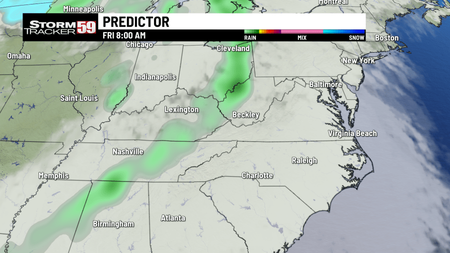
Friday kicks out our high pressure in favor of an arriving low pressure system. This system will bring back scattered showers, first arriving in the morning, and then becoming more hit or miss in the afternoon. A gloomy and wet end to the week but it will feel mild as temperatures get into the 50s.
Saturday keeps the chance for an isolated shower or two around during the day. Won’t be a total washout from the looks of things but keeping an umbrella around will help if you have any weekend plans. Temperatures will remain above average to start next weekend as they’ll be in the 50s.
In your extended forecast, we are keeping an eye on another low pressure system entering the region. This system looks to cross during Sunday night into next week, bringing in more chances for unsettled weather. Colder air will also start to filter in, dropping our temperatures from the 50s into the 30s by next Tuesday and Wednesday.
TONIGHT
Mostly clear. Calm overnight. Overnight lows near 30 degrees.
MONDAY
Dry. Sunny start to next week. Highs in the 50s.
TUESDAY
Sunshine continues. Dry and nice. Highs near 50 degrees.
WEDNESDAY
Mostly sunny again. Fantastic weather. Highs in the 50s.
THURSDAY
A few clouds build. But staying dry. Highs in the 50s.
FRIDAY
Showers return. Mostly cloudy. Highs in the 50s.
SATURDAY
Isolated showers. Mostly cloudy. Highs in the 50s.
SUNDAY
Dry start. Showers chances late. Highs in the 50s.
MONDAY
Showers return. Gloomy start to next week. Highs in the 50s.
TUESDAY
Colder day. Switch to some snow showers. Highs in the 30s.
WEDNESDAY
Snow chances linger, mostly MTN chances. Cold. Highs in the 30s.
For the latest news, weather, sports, and streaming video, head to WVNS.
Signup bonus from