(PINPOINT WEATHER) — Good evening and happy Saturday! After a beautiful Saturday, we are expecting mostly clear and quiet weather overnight, followed by more cloud cover on Sunday. Rain chances for Monday continue to look sparse outside of South Carolina. Overall, next week looks fairly dry and seasonal, with no real shower chances until we get to Friday.
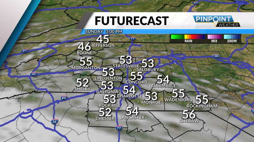
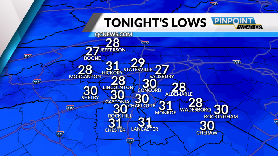
As for tonight and the rest of your weekend, mostly clear skies and light winds tonight will help to push our temperatures to around the freezing mark in Charlotte and 20s up into the mountains. Sunday looks dry, but we will see more clouds start to move in during the afternoon as our next storm system approaches the Southeast.
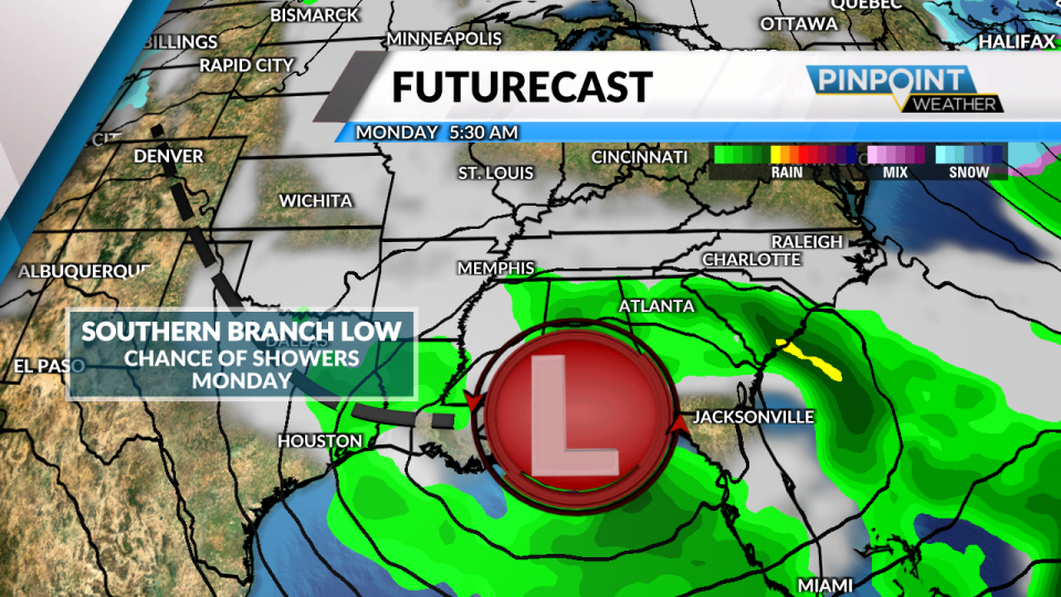
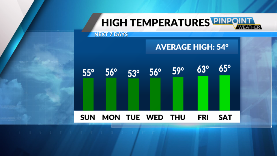
On Monday, we are watching an area of low pressure that will try to push some showers into Upstate South Carolina, but increasingly likely, just about all of the region will stay dry. High temperatures on Monday will be in the low 50s. The rest of the week looks relatively dry and seasonal, with temperatures in the mid-50s. Our next decent chance for showers comes on Friday with the start of a more active pattern with a frontal boundary stalling to our west. Showers are possible later in the day on Friday and could last through the evening hours.
In the meantime, enjoy the quiet and chilly weather tonight! Have a great night!
For the latest news, weather, sports, and streaming video, head to Queen City News.
Signup bonus from