A Dense Fog Advisory has been issued for Auglaize, Darke, Logan, Mercer, and Shelby counties from 10 p.m. until 11 a.m. Saturday.
A Dense Fog Advisory has also been issued for Wayne County, Indiana from 10 p.m. until 11 a.m. Saturday.
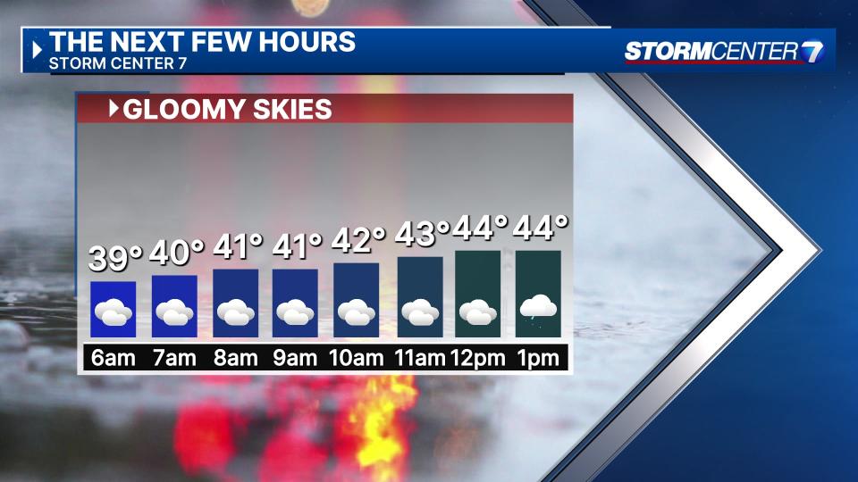
QUICK-LOOK FORECAST:
-
Rain returns late today
-
Transition to mix or all snow Sunday morning
-
Overall, temperatures staying above normal
>> TRACK THE LATEST CONDITIONS: Live Doppler 7 Radar
DETAILED FORECAST:
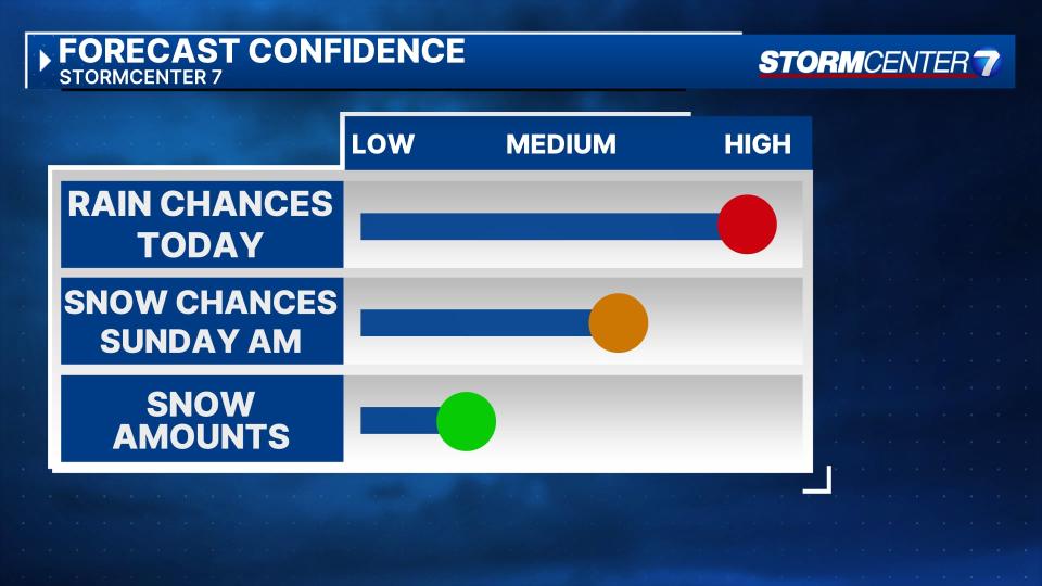
SATURDAY: Cloudy and mostly dry during the day. A chance for rain showers by late Saturday afternoon, continuing through Saturday night. As colder air wraps in Saturday night / Sunday morning, a transition to a rain snow mix or even all snow at times is possible.

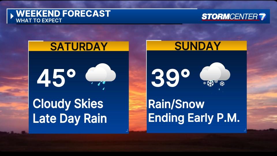
SUNDAY: A chance for rain or snow mainly before lunchtime on Sunday. Temperatures will be marginally supportive of this, only cooling to the mid 30s in most spots. It will be difficult for snow to amount to much, but areas that end up seeing snow could see slushy accumulations up to an inch or so.
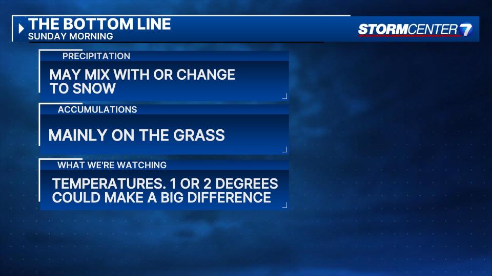
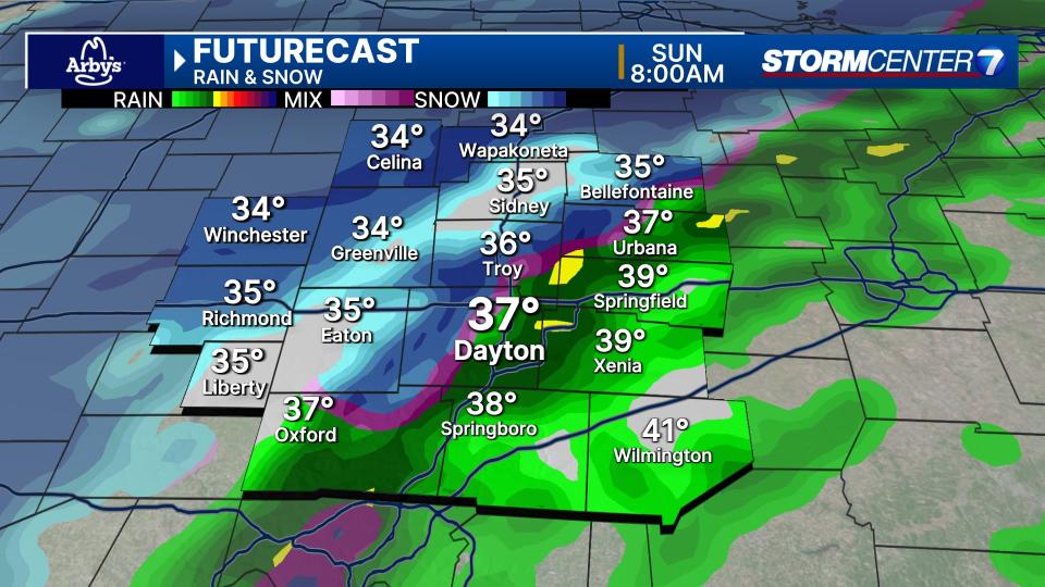
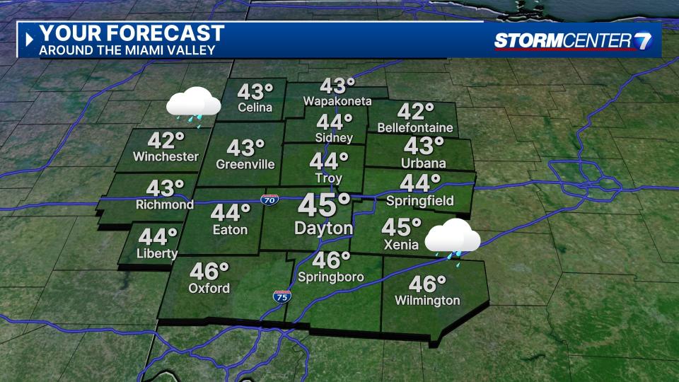
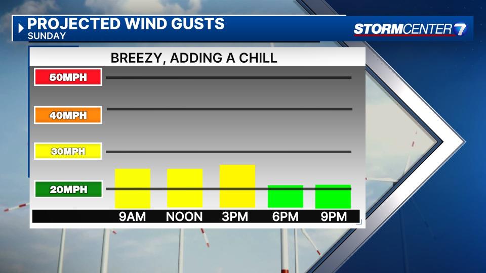
Some areas may stay all rain through the event. It all depends on the temperatures, so stay tuned as a degree or two could make all of the difference. Either way, with temps above freezing, travel should not become much of an issue. Morning lows in the low to mid 30s. Breezy with daytime highs around 40.
MONDAY: Mostly cloudy and a bit colder with highs in the upper 30s.
TUESDAY: Mostly cloudy with highs near 40. Slight chance of light rain late in the day into Tuesday night.
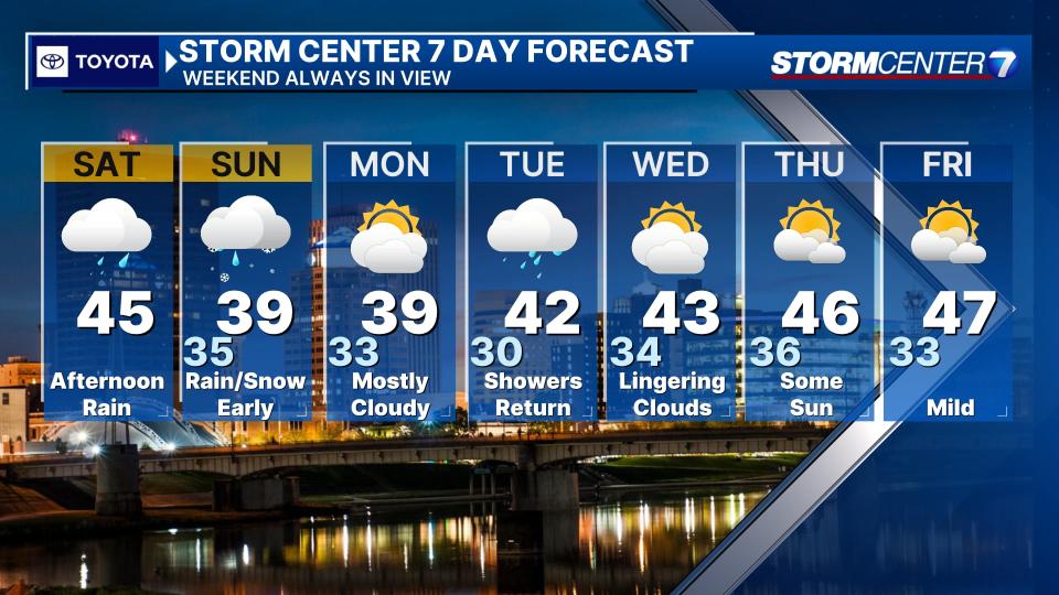
WEDNESDAY: A morning sprinkle possible. Partly cloudy. Cool with highs in the lower 40s.
THURSDAY: Partly cloudy and cool with highs in the mid 40s.
FRIDAY: Partly cloudy with highs in the mid 40s.
Signup bonus from