The National Weather Service has issued a Winter Weather Advisory for the entire region starting tonight from 8 p.m. until noon tomorrow. This includes Auglaize, Butler, Champaign, Clark, Clinton, Darke, Greene, Logan, Mercer, Miami, Montgomery, Preble, Shelby, and Warren counties in Ohio.
The National Weather Service has issued a Winter Weather Advisory for Randolph, Union, and Wayne counties in Indiana starting tonight from 8 p.m. until noon tomorrow.
Storm Center 7 Meteorologist Britley Ritz is tracking this system and will have a full update LIVE on News Center 7′s Daybreak beginning this morning at 4:25 a.m.
QUICK-LOOK FORECAST:
-
Freezing rain possible Monday night into Tuesday morning
-
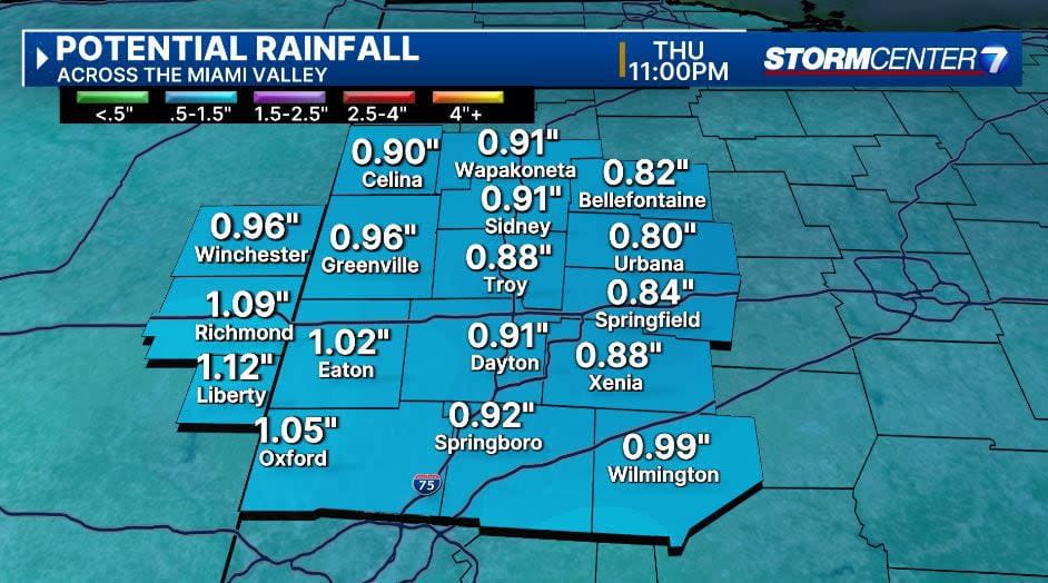
Rain train rolling in, sticking around for a few days
-
Significantly warmer temperatures, 20-plus degrees above normal
>> TRACK THE LATEST CONDITIONS: Live Doppler 7 Radar
DETAILED FORECAST:
MONDAY: Mostly cloudy and cold with a stray flurry possible during the day, according to Storm Center 7 Meteorologist Britley Ritz. Highs in the mid-30s which is pretty typical for this time of year.

Climbing back above freezing for the first time since January 13th.
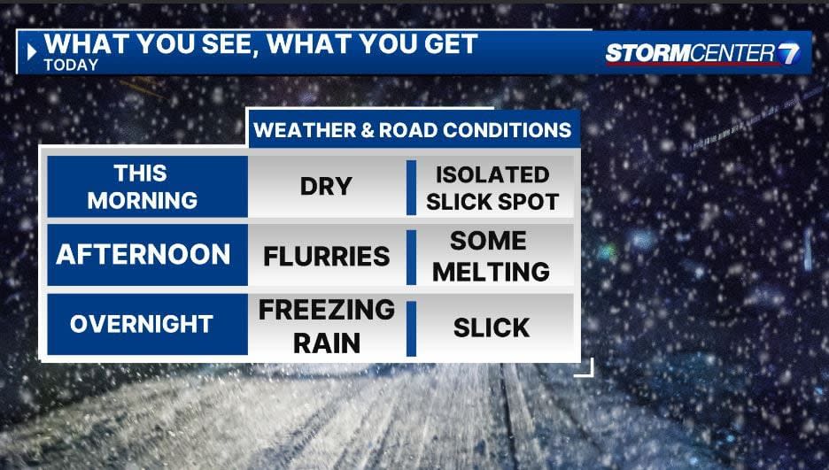
Overnight, some precipitation moves in, and confidence is increasing that this comes in the form of freezing rain.
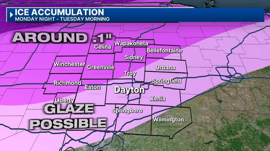
TUESDAY: Freezing rain is possible early Tuesday morning. Even if temperatures come above freezing, the ground is very very cold, and ice accumulation is possible for some time. Right now we are forecasting a glaze to one-tenth of an inch across the region. This could create some slick travel conditions along with slick surfaces such as sidewalks and handrails., Monday night into Tuesday morning.
Temperatures eventually warm to the lower 40s so this threat diminishes quickly by the afternoon.
WEDNESDAY: Cloudy with rain showers likely. Highs near 50.
THURSDAY: Cloudy with more showers likely. Much warmer with highs in the low to mid 50s.
FRIDAY: Mostly cloudy and mainly dry. Highs in the upper 40s to near 50.
SATURDAY: Staying cloudy with another round of rain possible late in the day into Saturday night. Highs in the mid-40s.
SUNDAY: Mostly cloudy skies with a stray shower possible. Cooler with highs in the upper 30s.
Signup bonus from


