Wind Advisory: Valid NOW until 8AM This Morning for Butler & Warren Counties in Ohio
Wind Advisory: Valid NOW until Noon Today for Randolph County
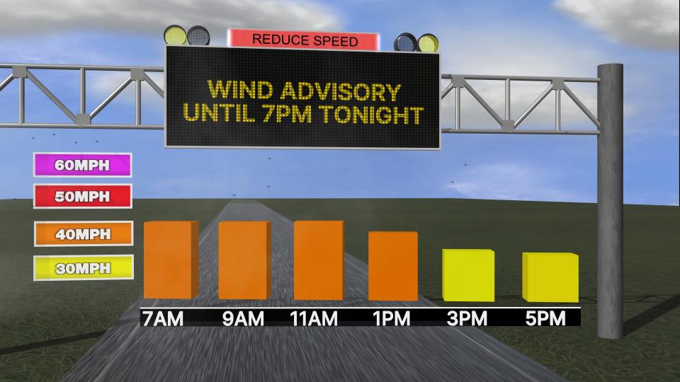
Wind Advisory: Valid NOW until 7PM This Evening for Wayne & Union Counties in Indiana, and Mercer, Auglaize, Logan, Shelby, Darke, Miami, Champaign, Clark, Preble, Montgomery, Greene, and Clinton Counties in Ohio


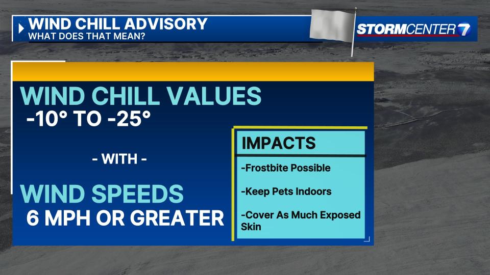
Wind Chill Advisory: Valid from 11PM This Evening until 3PM Sunday for Wayne & Union Counties in Indiana, and Mercer, Auglaize, Logan, Darke, Shelby, Montgomery, Clark, Greene, Miami, Preble Counties in Ohio
Wind Chill Advisory: Valid from 1AM Sunday to 1PM Sunday for Butler, Warren, Clinton Counties in Ohio
Wind Chill Advisory: Valid from 7PM This Evening to 1PM Sunday for Randolph County in Indiana
QUICK-LOOK FORECAST:
-
Light Snow this morning and this evening, staying windy
-
Dangerous Cold Temperatures setting in
-
Staying very cold into next week
>> TRACK THE LATEST CONDITIONS: Live Doppler 7 Radar
DETAILED FORECAST:

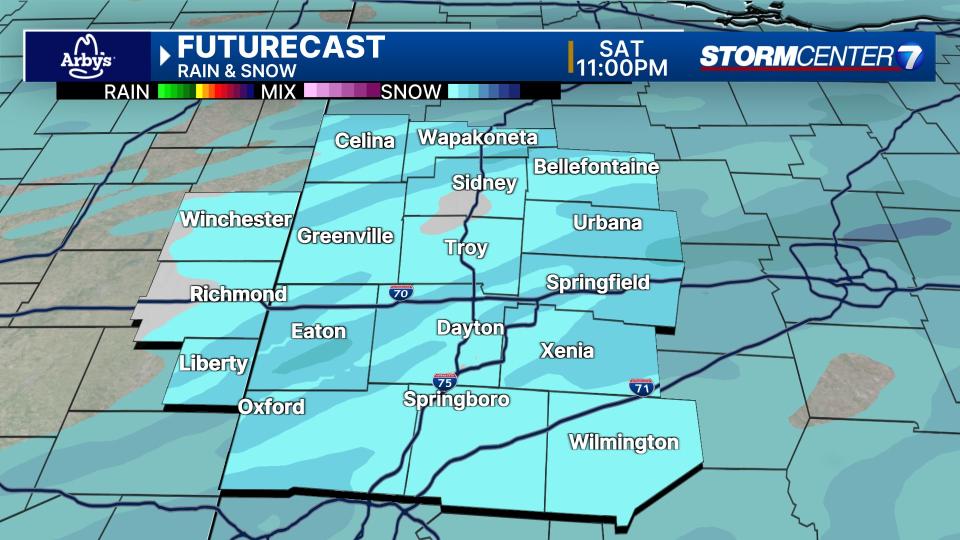
SATURDAY: A few snow showers may still be around real early Saturday. Then dry for much of the day followed by a few flurries or light snow showers Saturday evening.
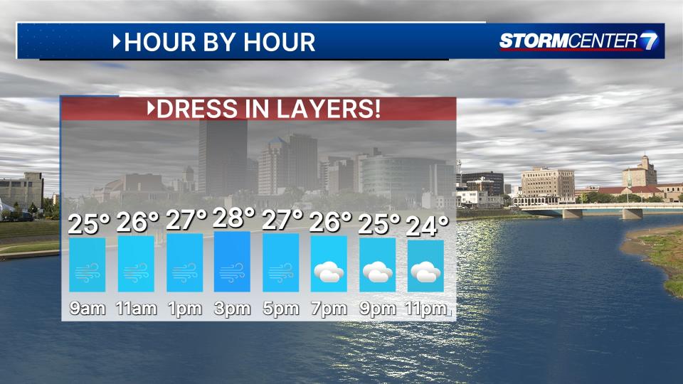
With cold temperatures, anything that falls will stick, but accumulations are still expected to be light. Afternoon highs rebound to the mid and upper 20s. Staying windy, with gusts of 40+ MPH lasting into the afternoon before slowly dying down some.

SUNDAY (COLD): Mostly cloudy. Dangerously cold. Lows in the single digits Sunday morning with wind chills -5 to -20. Only climbing to the low teens Sunday afternoon with wind chills not improving very much into the afternoon.
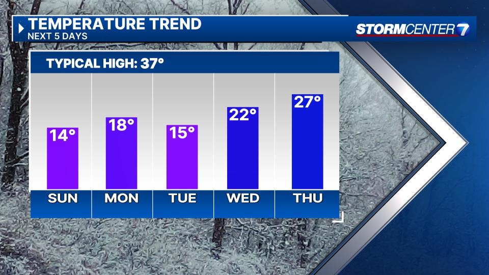
MONDAY (COLD): Dangerously cold Monday. Lows in the single digits with subzero wind chills once again. Afternoon highs in the teens. Mostly cloudy skies.
TUESDAY (COLD): Dangerously cold again. Colder than Monday with lows ranging from zero to 5 degrees. Afternoon highs in the mid teens. Subzero wind chills likely again. Light snow showers remain a possibility, but confidence is low on coverage and snowfall amounts.
WEDNESDAY (COLD): A third morning of low temperatures at or below 10 degrees. Afternoon highs climb back into the middle 20s. Dry with partly cloudy skies.
THURSDAY (COLD): Mostly cloudy skies. Cold, but not quite as bad. Lows in the upper teens and highs in the mid 20s.
FRIDAY: Cold with a chance for snow. Highs in the lower 20s.
Signup bonus from