A Wind Advisory has been issued for the entire Miami Valley from starting today at 11 a.m. until 8 a.m. on Saturday. This includes Butler, Champaign, Clark, Clinton, Darke, Greene, Logan, Mercer, Miami, Montgomery, Preble, Shelby, and Warren counties in Ohio. It is also in effect for Union and Wayne counties in Indiana.
A High Wind Watch is in effect for Randolph County in Indiana starting Friday afternoon until Saturday morning.
QUICK-LOOK FORECAST:
-
Major storm system Friday – Saturday
-
Gusts to 50 m.p.h. possible
-
Some snow as system exits
>> TRACK THE LATEST CONDITIONS: Live Doppler 7 Radar
DETAILED FORECAST:
HEADLINES:
FRIDAY: A frosty start with rain and snow mix arriving late morning. A sloppy day is expected on Friday. according to Storm Center 7 Meteorologist Britley Ritz.
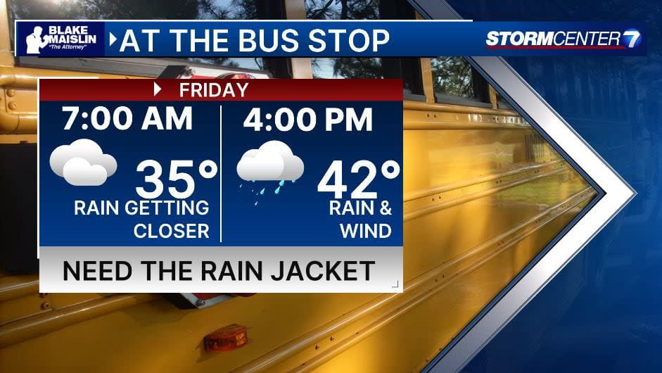
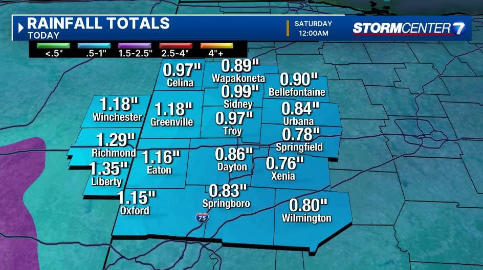
Precipitation may begin as a brief mix of rain, sleet, and snow Friday morning before quickly changing to all rain Friday afternoon. Highs climb to the middle 40s.
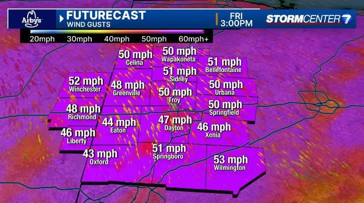
Very windy. Sustained winds 25-30 m.p.h. Gusts of 40-50 m.p.h. is possible. A few areas across the northwest Miami Valley may see gusts exceeding 50 m.p.h. Friday evening.
Friday night, moisture is pulling away as colder air arrives. The overlap of whatever moisture is left will result in some light snow showers.
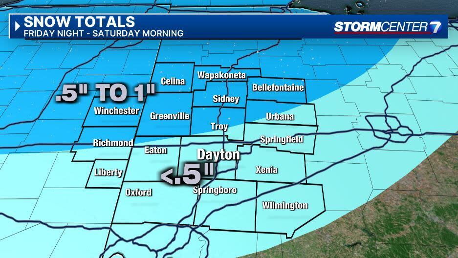
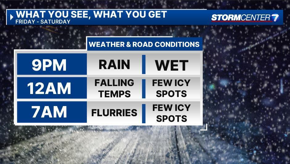
SATURDAY: Snow showers are possible, especially early Saturday. Accumulations will be light and scattered. Some areas may receive up to 1″ especially further to the northwest. Most everybody is looking at a half-inch or less. Much colder. Daytime highs only reach the upper 20s.
SUNDAY: Mostly cloudy. A few snow flurries can’t be ruled out. Very cold. Single-digit morning low temperatures and afternoon highs in the teens.
MONDAY: Dangerously cold Monday. Lows in the single digits with subzero wind chills. Afternoon highs in the teens. Mostly cloudy skies.
TUESDAY: Dangerously cold again. Colder than Monday with lows ranging from zero to 5 degrees. Afternoon highs in the mid-teens. Subzero wind chills are likely again. Some light snow showers may be around Tuesday morning with the best chances south of Dayton.
WEDNESDAY: A third morning of low temperatures at or below 10 degrees. Afternoon highs climb back into the middle 20s. Dry with partly cloudy skies.
THURSDAY: Mostly cloudy with a few flurries. Cold, but not quite as bad. Lows in the upper teens and highs in the upper 20s.
Signup bonus from