It looks as if winter is just beginning.
The Iowa City area is bracing for another winter storm with the potential to produce 10 inches of snow across a 36-hour period. Strong winds, blizzard-like conditions, and frigid temperatures are expected to quickly follow and extend through early next week.
The Quad Cities National Weather Service [redicts freezing rain and ice could cause various issues as well, with roughly one-tenth of an inch of ice expected to accumulate throughout Thursday night and Friday morning.
Snow is expected to begin falling late Thursday night at some point after 9 p.m., with the potential for freezing rain mixed in.
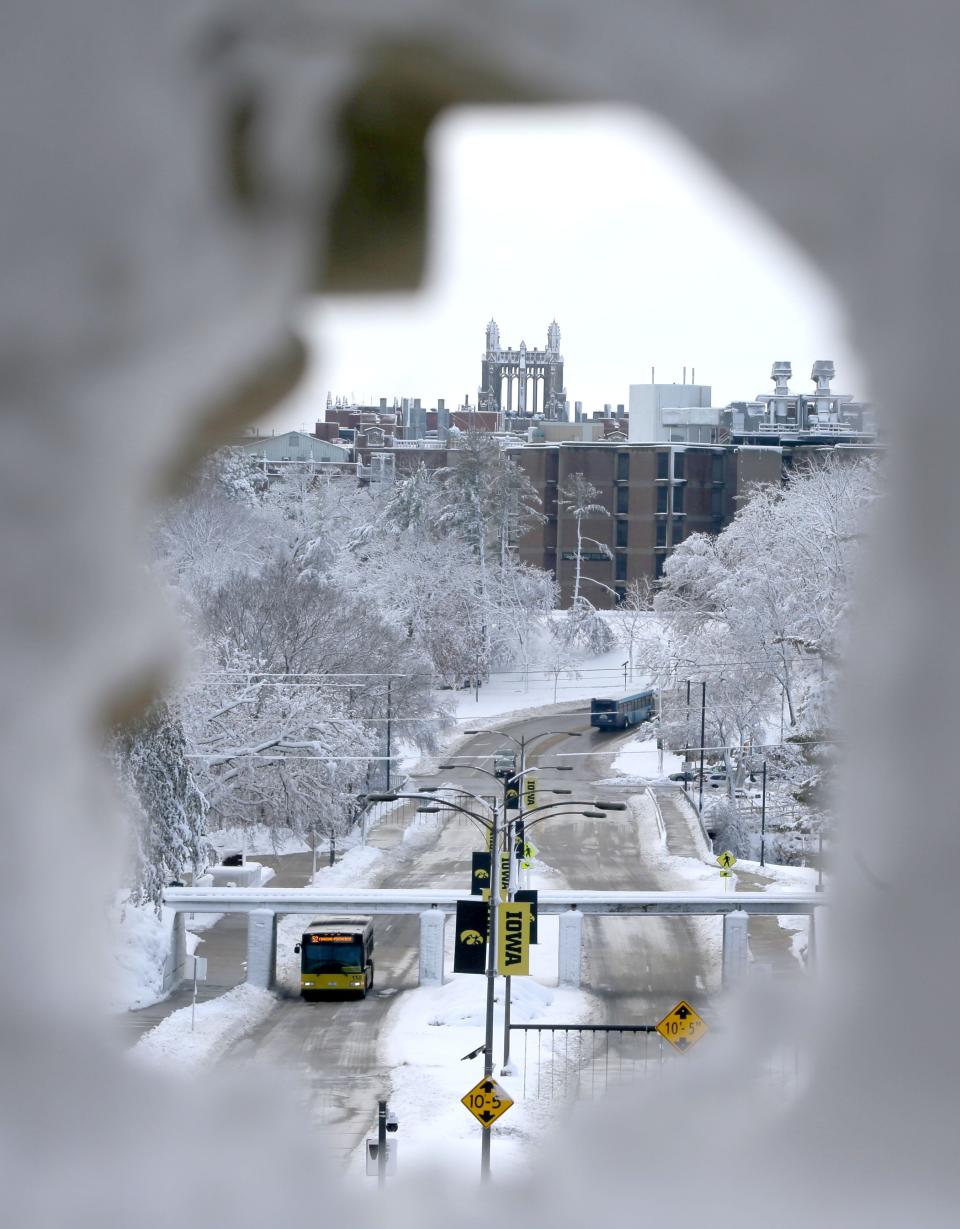
This front comes just a few days after a winter storm blanketed Johnson County over a two-day span (Jan. 8-9), which produced a staggering 15 inches of snow. The year’s first big snow event generated several travel issues, causing many accidents on Interstate 80, which led the Iowa DOT to advise against travel in the area for nearly 24 hours.
More: Iowa City area blanketed by nearly a foot-and-a-half of snow, but records were not broken
National Weather Service issues second winter storm warning this week
The Quad Cities National Weather Service issued a winter storm Thursday morning, the second of the week. The latest warning is expected to begin at 9 p.m. Thursday and extend through Saturday morning, Jan. 13, expiring at noon.
A winter storm warning, as defined by the National Weather Service, means a “significant winter storm is imminent and (there) is a danger to life and property.”
Snow is expected to begin falling after 9 p.m. Thursday, continuing throughout the day Friday and into the early morning hours Saturday. The potential for freezing rain has added a wrinkle to the latest winter storm as officials predict mixed precipitation of snow and freezing rain Friday morning could create slick road conditions for commuters.
Forecasters also expect blizzard conditions to develop Friday night and continue into Saturday, with the potential for 50 mph high winds blowing snow across roadways, creating whiteout conditions.
Here is one forecast model depiction of the upcoming storm. Snow arrives late this evening, with mixed precip moving in from the south in the AM creating slick hazardous travel. All precip will changeover to snow Friday afternoon/PM with VERY strong winds. pic.twitter.com/E53q9AnfVe
— NWS Quad Cities (@NWSQuadCities) January 11, 2024
More: Road conditions in Johnson County area slowly improving after a number of snow-related crashes
How much snow will fall in Iowa City?
Forecast models expect Iowa City to receive between five and nine inches of snow, with the highest amounts expected north of Interstate 80 where some areas could see nearly another foot of snow.
The National Weather Service gives the Iowa City area a 64 percent chance to receive more than six inches of snow, with much of the snow falling in the overnight hours Thursday and throughout the day Friday.
(2/5) Here’s a look at forecast snowfall totals for the upcoming winter storm, as well as the potential to exceed six inches of snow.
Remember, it’s much more than just how much snow falls that results in impacts, especially to roads. It’s also snow rates, winds, and more. pic.twitter.com/t36Ag5ECSC
— NWS Quad Cities (@NWSQuadCities) January 11, 2024
Frigid cold expected over the weekend
The National Weather Service also predicts sub-zero temperatures to move into the area after the snow has stopped. The organization predicts wind chills to quickly drop below zero Saturday evening, continuing through much of the next week.
A low of -11 degrees is forecasted for Saturday night accompanied by strong winds, yielding to Sunday’s frigid high of -1 degree. The Iowa City isn’t expected to surpass zero degrees again until Tuesday, with Sunday night’s low expected to dip to -18. A high of zero is predicted for Martin Luther King, Jr. Day (Jan. 15) while Monday night’s low will again be well below zero at -14 degrees.
The National Weather Service is expecting overnight wind chills do dip into the -20 and -30 degree range throughout the long weekend.
Tuesday’s high will be a balmy four degrees, though the temperature will drop significantly overnight, with lows predicted at -7 degrees.
Dangersous conditions
The latest winter storm could pose even more danger than earlier in the week. The combination of heavy snow, strong winds, freezing rain, and sub-zero temperatures could create treacherous conditions for even the most-season winter veterans.
“A very complex system with cold air and strong winds are likely Friday evening through Saturday,” the National Weather Service said in a tweet Thursday morning. “Blowing and drifting snow will be possible with this system. Travel will be difficult.”
The National Weather Service encourages residents to consider all the factors before venturing out of their home in the next few days. Officials warn of falling tree branches due to the strong winds, heavy snow, and freezing rain.
More: With plenty of snow to enjoy, here are the best places to sled in the Iowa City area
“Remember, it’s much more than just how much snow falls that results in impacts, especially to roads,” the Quad Cities NWS said in a Thursday morning tweet. “It’s also snow rates, winds and more.”
Up-to-the-minute road conditions can be viewed on the Iowa DOT’s website.
Brandon Hurley is the editor of the Iowa City Press-Citizen. He can be reached by email at bhurley@gannett.com or on X.com (@brandonjhurley).
This article originally appeared on Ames Tribune: When is the latest snow storm expected to hit Iowa City?
Signup bonus from