A strong storm system battered Beaufort County with rain and heavy winds Tuesday afternoon — but reported damages appear to be minimal as power slowly returned to the Lowcountry.
Fire officials from across the county said the volume of storm-related calls was about what they expected. Despite a sizable number of downed trees, no injuries or significant property damage was reported.
Just after 3 p.m., crews from the City of Beaufort/Town of Port Royal Fire Department responded to a small structure fire at a business in the 1800 block of Boundary Street, which closed the roadway for less than an hour in downtown Beaufort. The flames were put out by a fire extinguisher and likely started in a surge protector, according to spokesperson Ross Vezin.
Peaking at nearly 17,000 affected customers around 4 p.m. Tuesday, power outages dwindled as the night went on. As of 9 p.m., Poweroutage.us reported just over 1,000 households without power — nearly all of which came from Dominion Energy, whose Hilton Head customers experienced widespread blackouts after a small tree impacted a mid-island Santee Cooper power line.
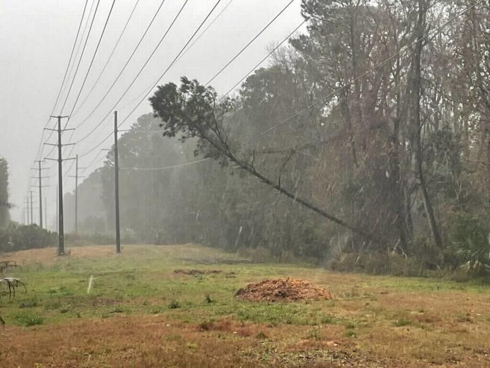
Winds reached a high point around 4 p.m. Tuesday, with a maximum sustained wind speed of 37 m.p.h and gusts reaching up to 53 m.p.h., according to data from the National Weather Service (NWS).
Although the local tornado watch and severe thunderstorm warning ended before 6 p.m., Beaufort and Jasper Counties were still under a handful of weather warnings Tuesday night: a high surf advisory until midnight and a wind advisory lasting to 6 a.m. Wednesday.
The NWS also issued a special weather statement Tuesday night, warning of downed trees and power lines that might impact drivers overnight — especially on secondary roads and rural highways.
Other areas of the southeast and south had more extensive damage as wind, possibly from tornadoes, ravaged areas of Alabama, Florida, and Georgia, as well as North and South Carolina. In Florida’s panhandle, images of a marina building and mobile homes severely damaged by the storm demonstrated the force of the storm as it moved across the states.
Meteorologists on The Weather Channel devoted Tuesday to tracking what they called a 600-mile long cyclone that moved from states near the Gulf of Mexico to all the way up the eastern seaboard, bringing winds, rain, and tornadoes to the south and wet snowfall to the northeast.
In Bamberg, SC, reports of a tornado touching down near a Edisto Electric Cooperative building causing damage will be investigated Wednesday as cleanup activities are completed.
Signup bonus from


