A powerful low-pressure system that will move across the state arrived in the mountains before midnight and began making its way across the state Tuesday, bringing heavy rain and gusty winds.
The National Weather Service said Asheville had received 1.35 inches of rain between midnight and 7 a.m., then got another 2.3 inches of rain between 7 a.m. and 1 p.m. Tuesday.
Rain began to hit central North Carolina before noon.
When we’ll see the worst weather in the Triangle
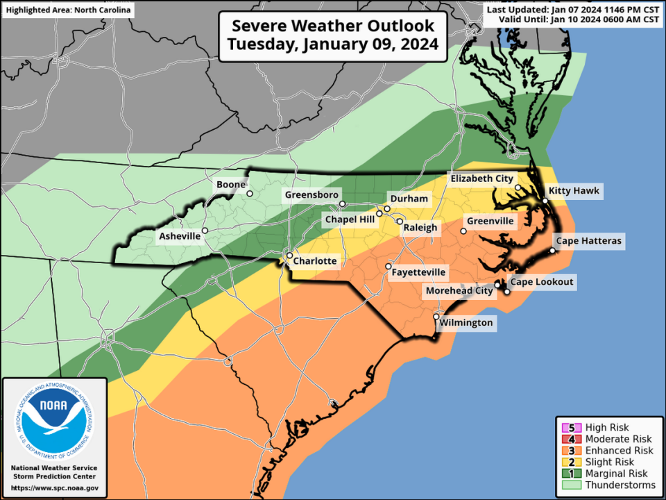
The heaviest rains and strongest winds from the storm are likely to happen between 2 p.m. and 9 p.m. for central and Eastern North Carolina.
The National Weather Service issued a tornado watch Tuesday afternoon for the Sandhills, in effect until 9 p.m.
Power outages reported across the state
Power outages are anticipated as conditions worsen through the day, and a few hit early. In the Sandhills, a section of Sanford was in the dark for about an hour before Duke Energy was able to bring customers back online.
Just after noon, Duke Energy reported an outage affecting about 3,000 customers in Durham’s southeastern corner.
Duke reported another outage affecting about 1,500 customers in Cary. That outage stretched from the southeastern corner of Downtown Cary to the intersection of Cary Town Boulevard and Walnut Street. Estimated times of restoration were not available for either outage.
Flooding expected with heavy rain, high winds
North Carolina has braced for the storm. Residents cleared grocery shelves of bread, beer and milk days before Gov. Roy Cooper declared a state of emergency in order to have resources ready to deal with major problems.
Heavy rain from the storm — up to 5 inches in a few places in the mountains and foothills, and 1.5 inches to 3 inches in most of the rest of the state — could cause flooding in rivers and low-lying areas, forecasters said.
Central N.C., including Raleigh, Durham and Chapel Hill, will likely see at least 1.5 inches of rain and sustained winds of 15 to 25 mph, with gusts up to 45 mph.
High seas along NC coast
Along the coast, conditions on Pamlico Sound were already rough enough Tuesday morning that the N.C. Department of Transportation suspended ferry service between Ocracoke and both Swan Quarter and Cedar Island starting at 7 a.m. The Southport-Fort Fisher and Cherry Branch-Minnesott Beach ferries were halted later in the morning. NCDOT doesn’t expect to resume ferry service until midday Wednesday.
In an afternoon update, the National Weather Service said seas along the N.C. coast were building faster than expected, and conditions would worsen there through the day, especially along the Outer Banks and Carteret County. Seas will build through the day, forecasters said, peaking at 15-25 feet. Hurricane-force wind gusts are likely across the coastal waters and the Pamlico Sound Tuesday evening, forecasters said.
This story will be updated throughout the day.
Signup bonus from